


|
At SJ Geomatics Ltd, we provide high-accuracy land surveying services that form the essential foundation for successful planning, design, and construction. With decades of combined industry experience and a commitment to technical excellence, we deliver precise spatial data that our clients can trustno matter the size or complexity of the project. |
| Our Approach |
|
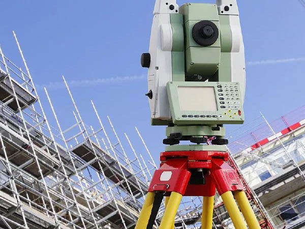
We combine traditional surveying expertise
with the most advanced tools available,
including robotic total stations, GNSS/GPS
equipment, 3D laser scanners, and UAV/drone
photogrammetry. This integrated approach
allows us to work efficiently on all types
of terrain and produce exceptionally
detailed, accurate survey data. Every project begins with understanding your objectives and constraints. We work closely with architects, engineers, developers, contractors, and landowners to ensure every survey is tailored to the specific requirements of the site and the intended design or construction works. |
| Our Surveying Services |
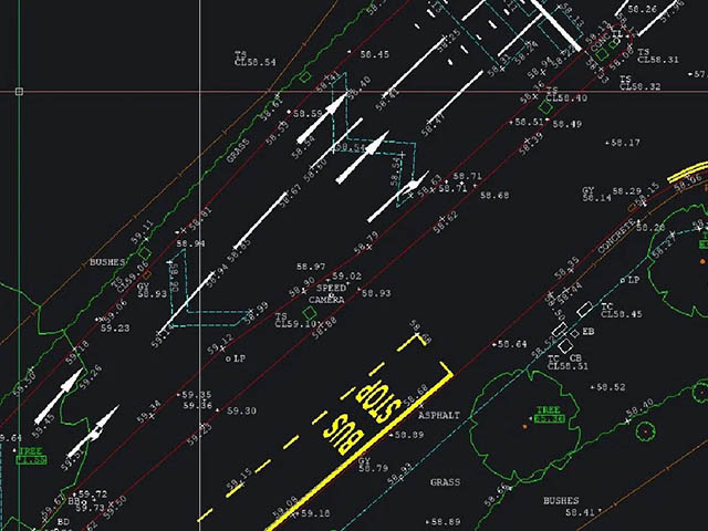
| Topographical Surveys |
| Our topographical surveys provide a precise representation of all natural and man-made features on site, including levels, buildings, boundaries, utilities, vegetation, drainage, and access points. Delivered in a range of formats (DWG, PDF, 3D models, point clouds), these surveys support planning applications, concept design, detailed engineering, and construction. |
| GPR/EML Underground Void/Utilities Surveys |
|
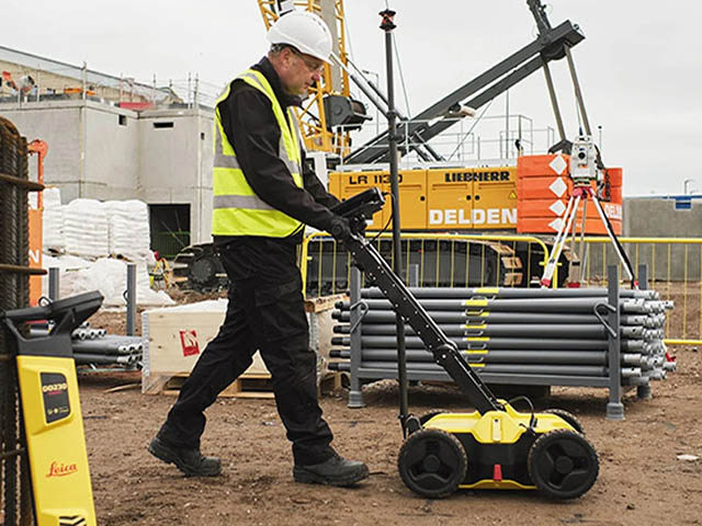
When it comes to excavation, construction,
design, or utilities work, what lies beneath the
surface can make or break a project. At SJ
Geomatics Ltd, we specialise in delivering
high-resolution underground surveys using
Ground Penetrating Radar (GPR) and radio
detection (EML/CAT & Genny) technologies.
Our goal is simple: give our clients the
confidence to dig safely, design smartly, and
reduce risk. In today's built environment, underground congestion is increasing - from power and telecoms to water, gas, drainage, and unknown legacy services. Knowing the full picture underground isnt just helpful; its essential. |
| Boundary Disputes |
| We undertake boundary surveys to identify exact property extents, resolve boundary uncertainties, support land registration, and provide evidence for legal or neighbour disputes. Our accurate mapping and clear reporting provide confidence and clarity for landowners and developers. |
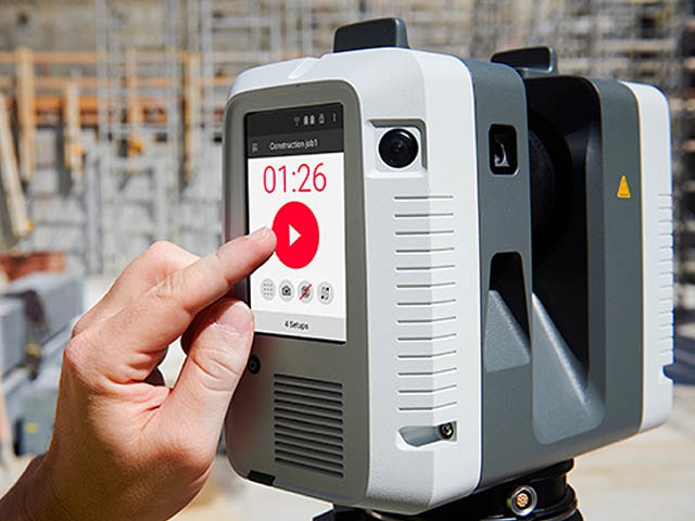
| Measured Building Survey |
| Floor Plans, Elevations, Sections (Cut and Elevational), Reflective Ceiling Plans and Roof Plans. With a combination of 3d Laser Scanner and Total Station technology we have got this covered. |
| Revit Modelling |
| At SJ Geomatics Ltd, weve always believed that accurate data is the foundation of every successful project. As the construction and engineering sectors continue to move toward digital delivery, the demand for rich, intelligent 3D models has never been higher. Thats why Revit modelling has become a core part of the services we deliver for clients across the UK. |
| As-Built & Verification Surveys |
| To ensure construction is progressing as intended, we offer as-built and verification surveys that compare completed works against design models or specifications. This helps contractors maintain quality control, avoid costly rework, and document compliance. |
| UAV/Drone Surveys |
| Using the latest drone technology, we capture high-resolution aerial data for large or inaccessible areas. Drone surveys are ideal for mapping quarries, farmland, earthworks, industrial sites, and large development plots, delivering fast, accurate results with minimal site disruption. |
| Setting Out |
| At SJ Geomatics Ltd, accuracy is at the core of everything we do and nowhere is this more critical than in setting out. Before any structure can take shape on site, it needs to be positioned with absolute precision. Thats where our experienced setting out engineers and surveyors add real value, ensuring every line, level, and coordinate is exactly where it should be. In an industry where mistakes can be costly, reliable setting out isnt just a service its an essential part of project success. |
| Why Choose SJ Geomatics Ltd? |
|
High
Accuracy: We use industry-leading
equipment and quality-assured workflows to
deliver consistently dependable data. Clear Deliverables: All surveys are presented in clear, easy-to-use formats tailored to client needs. Fast Turnaround: We understand project pressures and deliver data quickly without compromising quality. Experienced Team: Our surveyors are trained, knowledgeable, and committed to delivering exceptional service. Nationwide Coverage: Based in East Anglia, we serve clients across the UK. |
| Supporting Every Stage of Your Project |
|
From initial feasibility studies to
construction verification and final
handover, SJ Geomatics provides the
surveying insight needed to plan, design,
and build with confidence. Our goal is
simple: to give you accurate information,
minimise risk, and support better project
outcomes. Our services include:- - Topographical Surveys - Bathymetric Sonar Surveys - Measured Building Surveys - 3d High-Definition Scanning / Pointcloud Data - BIM & Revit modelling - Drone Surveys / Aerial photography & 4K Videos - Thermographic Surveys / Crop Analysis - 3d Virtual Tours - Setting Out Services - Land Registry Compliant Plans - GPR Underground Utility Surveys - Rebar Scanning - AutoCAD Services & Conversion |
Areas CoveredOur 3D Laser Scanning Surveys, Topographical Land Surveys and everything else are available throughout Suffolk, East Anglia and the rest of the UK: |
Opening Hours
Accepted Payment Methods


Payment Terms
Key Personnel

Reviews
 SJ Geomatics Ltd
01986 872716
48a Thoroughfare
SJ Geomatics Ltd
01986 872716
48a Thoroughfare Halesworth Suffolk
IP19 8AR 5
We used SJ Geomatics for a site survey, and they were excellent! Quick to respond and get out to the site, providing a smooth and professional service. They were very reliable throughout the process. Would definitely use them again and highly recommend their services.
SJ Geomatics Ltd
01986 872716
48a Thoroughfare Halesworth Suffolk
IP19 8AR 5
Excellent service with fast turnaround and very reasonably priced compared to other companies.