|
All of our surveys are related to national
grid position and level at no additional cost to
our clients. Quality is extremely important to
us because it impacts on our clients. We have
lead by example in gaining ISO9001 and ISO14001
accreditation and having been audited and passed
by CHAS, Constructionline and The Survey
Association for quality and health and safety.
We are also members of The Federation of Small
Businesses and currently have a certificate of
commitment for Investors In People. Our surveys
are able to provide services throughout East
Anglia, Suffolk and further afield. |
|
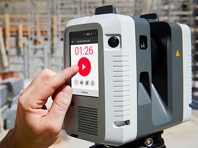
3D Laser Scanning Surveys |
SJ Geomatics are the first company in the UK
to purchase the new FARO120 3d Laser Scanner.
With 3d Laser Scanning at a rate of 920,000
points per second and at an improved range of up
to 150 metres we can assure our clients of superb
3D Laser Scanning Surveys at a competitive price. Points
cloud data can be issued or information
extracted using Pointools and Rhino for
deliverables in many formats including Sketchup,
AutoCAD, Rhino and 3d Studio.
Applications include:-
-
Architectural/Heritage scans
-
Highway surveys
-
Railway
-
Forensic/Accident Reports
-
Tree surveys for use by arborists
-
Large Products
-
Petrochemical Industry
-
Power Plant and Nuclear Industry
-
Mining and Tunnelling
-
Chemistries and Food
-
Process Automation |
|
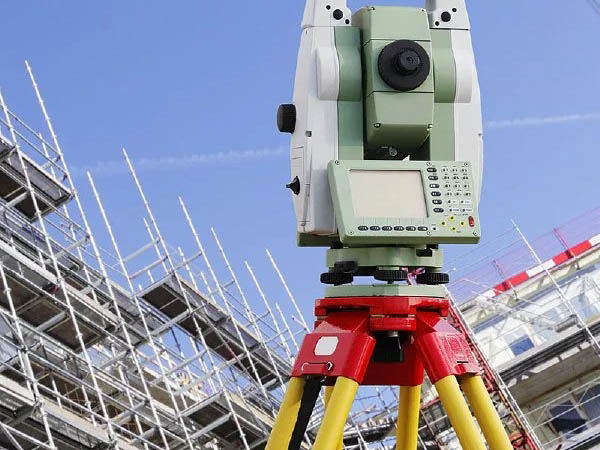
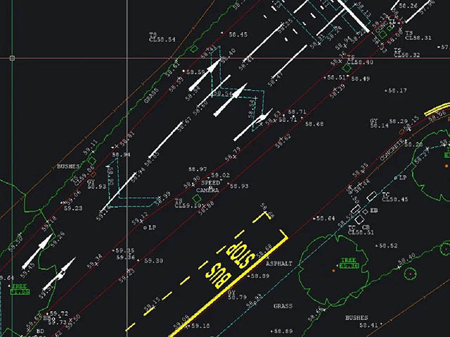
Topographical Land
Surveys |
During the initial phase of any development or
project Topographical Land Surveys are a
requirement. Our topographical land surveys are
constructed from measured elevation points and
presented as contour lines on a plot, below are
some of the main uses for our topographical land
surveys:
-
GPS Topographical Surveys for flood risk
assessments
- Highway surveys showing road markings and
signage
- Boundary surveys for conveyancing or
disputes
- Site surveys for development
- Landscaping surveys for Landscape
Architects
- Tree surveys for use by arborists
- Coastal defence surveys
- Control Networks (PGM)
- Areas
- Volumetric surveys/Cut Fill calculations |
|
Land Surveys |
-
Scaled floor plans to suit specification and
scale
-
General Arrangement Plans
-
Elevations (Basic or Detailed)
-
Street Scenes
-
Internal Elevations
-
Sections
-
Photogrammetry
-
Roof Plans |
|
Drone Surveys |
We can carry
out drone surveys producing Aerial Photographs,
GPS UAV Mapping, Building Elevations, 3D Virtual
Modelling and 3D Virtual Flythrough.
Aerial Footage
Using our UAV we can stipulate high
resolution aerial photographs over any given
area. The UAVs allow for access to awkward
places such as rooftops where this would allow
for further planning or detailed inspections,
lakes or large bodies of water and to give a
clear idea of the progression and visual outcome
of building sites and improvements.
Aerial Flyover/Flythrough
-
High Resolution flyover footage of buildings &
landscapes
-
High Resolution flythrough footage of buildings
-
3D model flyover/flythrough of buildings and
landscapes
-
Optimising Crop Yield
-
Vegetation Indices
-
Ensuring drought is overcome and damage is
lessened
-
Plant Counting: Height of the crops and the
density |
|
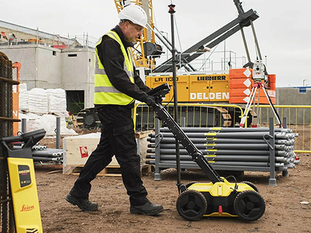
Underground Utility Surveys |
-
Accurate position of underground services
-
Accurate depths of underground services
-
Identification of underground services
-
Mapping subterranean pipelines and tunnels
-
Pre-drilling/digging analysis
-
Detection of storage tanks and voids |
|
Areas Covered |
|
Our
3D Laser Scanning Surveys, Topographical Land
Surveys and everything else are available
throughout Suffolk, East Anglia and the rest of
the UK: |
Bath
Bedfordshire
Berkshire
Blackpool
Bolton
Bournemouth
Bradford
Brighton
Bristol
Buckinghamshire
Cambridge
Cambridgeshire
Cheshire
Colchester
Cornwall
County Durham
Coventry
Cumberland
Cumbria
Derby
Derbyshire |
Devon
Dorset
Duhram
East Sussex
Essex
Gloucestershire
Greater London
Greater Manchester
Hampshire
Herefordshire
Hertfordshire
Ipswich
Isle of Wight
Isles of Scilly
Kent
Lancashire
Leeds
Leicester
Leicestershire
Lincolnshire
Liverpool |
London
Luton
Manchester
Merseyside
Milton Keynes
Newcastle
Norfolk
North Yorkshire
Northamptonshire
Northumberland
Norwich
Nottingham
Nottinghamshire
Oxford
Oxfordshire
Plymouth
Portsmouth
Reading
Rhyl
Romford
Rutland |
Sheffield
Shropshire
Somerset
South Gloucestershire
South Yorkshire
Southampton
Staffordshire
Stevenage
Suffolk
Sunderland
Surrey
Swindon
Tyne & Wear
Warrington
Warwickshire
West Midlands
West Sussex
West Yorkshire
Wiltshire
Worcestershire
Yorkshire |
|


